Seismic risk is the combination of the threat posed by faults capable of generating significant ground movement during earthquakes and the vulnerability of populations and infrastructure exposed to this possible ground movement.
The island of Haiti straddles the geological border between the Caribbean and North American tectonic plates, that move past each other at a speed of 2 cm/year. The movement between the two plates is taken up by faults, two major ones in particular: the Septentrional fault in northern of Haiti and the Southern Peninsula (or Enriquillo Plantain-Garden) fault in the south. The first one absorbs about 10 mm/year of the total plate motion, the second 7 mm/year.
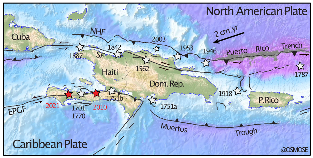
The continuous movement between the Caribbean and North American plates exerts constant mechanical forces on these faults. Although plate movement is continuous, that of the faults is discontinuous in time because they offer mechanical resistance to the movement of the plates. As a result, most of the time faults are stuck and not moving. But as plate motions continue inexorably, there necessarily comes a time when the accumulated forces on a fault exceed its mechanical resistance. A sudden slip of that fault then occurs: it is an earthquake.
This earthquake threat is non-negotiable: these faults have existed for millions of years and, because plate motions are inexorables, they will continue to behave seismically for million years to come. Settling next to them implies accepting that one day or another they will produce earthquakes!
Conversely, vulnerability is entirely the responsibility of the populations and their governments. It is managed by a reasoned land use and a quality of construction adapted to the level of threat. This requires above all common sense and a few simple recipes well known to engineers, architects and urban planners.
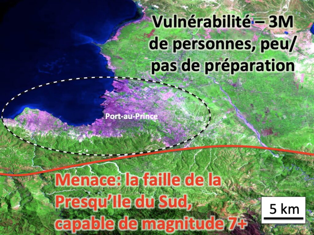
This was the “risk cocktail” in place in the metropolitan area of Port-au-Prince on January 12, 2010: as the image above shows, a major active fault is located just a few kilometers from an exposed and vulnerable mega-city. Today the risk is still present because neither the threat — natural and inexorable — nor the vulnerability — constructed — have changed significantly since 2010.
Here is a summary of earthquake risk in Haiti, in 7 essential bullet points:
- The seismic threat in Haiti has been known — and described! — since the 18th century.
- We know since the 1960s that earthquakes in Haiti are the result of the relative movement of the Caribbean and North American tectonic plates.
- We can now directly measure the speed at which seismic faults in Haiti accumulate the energy that they will release during future earthquakes.
- The earthquake of January 12, 2010 released little seismic energy — it was not the “big one”, which is always expected…
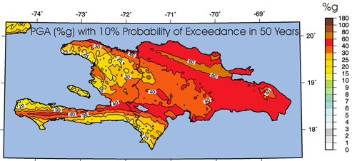
- We know the possible ground shaking during future earthquakes over the entire Haitian national territory, with additional details in Port-au-Prince and in the capitals of the north.
- Without vulnerability, no risk: the location and quality of construction is critical to minimize losses during future earthquakes.
- Reduce the risk: the solutions are in your hands!
I