Seismic threat in Haiti has been known — and documented — since the 16th century!
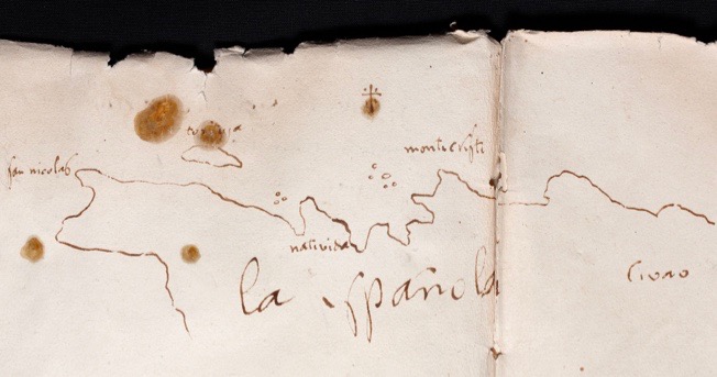
Major earthquakes on the island of Haiti have been known for as long as written records have come down to us. The first recorded event dates back to 1562: it devastated the first city in the New World, “Santiago de los Trenta Caballeros”, founded by Christopher Columbus in 1492 immediately after his landing on the northern coast of the island. The city was built in the Cibao Valley at a place called Jacagua, in what is now the Dominican Republic. At the time, it was unknown that the Cibao Valley coincided with a major seismic fault, the Septentrional Fault… Following the earthquake, the inhabitants decided to abandon the city and rebuild it a few kilometers away — it is now the large city of Santiago, with nearly a million inhabitants. But modern Santiago is still located along the Septentrional Fault… The latter has not experienced a major earthquake for nearly 500 years, so Santiago is particularly threatened.
The historian Moreau de Saint-Méry (1750—1819) is credited with the first census of natural disasters in what was then called the island of Saint Domingue, during the French and Spanish occupations. He reports 18 earthquakes felt, including the one of 1564 mentioned above, and those of October 18, 1751, November 21, 1751 and June 3, 1770, which caused major damage in Port-au-Prince.
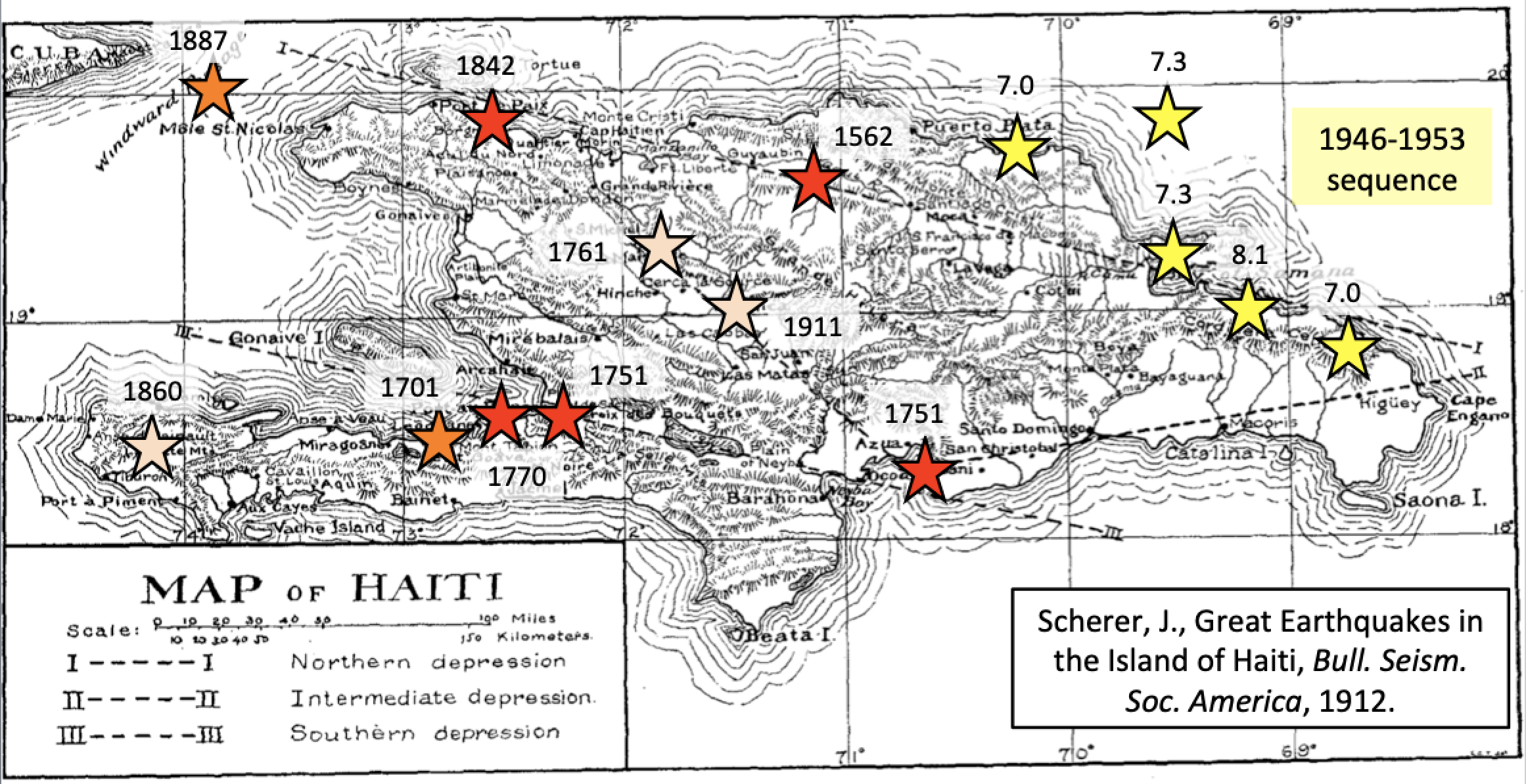
But the first scientific work on earthquakes in Haiti was that of Father Scherer (1858-1926), who was director of the Observatory of the Petit Séminaire du Collège Saint Martial in Port-au-Prince. He had equipped this observatory with a seismometer that operated from 1908 to 1966. In a major publication in the Bulletin of the American Seismological Society, he reanalyzed the events recorded by Moreau de Saint-Méry and some subsequent earthquakes, including that of May 7, 1842, which was catastrophic for the far north of Haiti, that of October 6, 1911 — of lesser intensity but which affected the center of the island, and that of April 8, 1860, strongly felt in the region of Anse à Veau in the Presqu’ile du Sud.
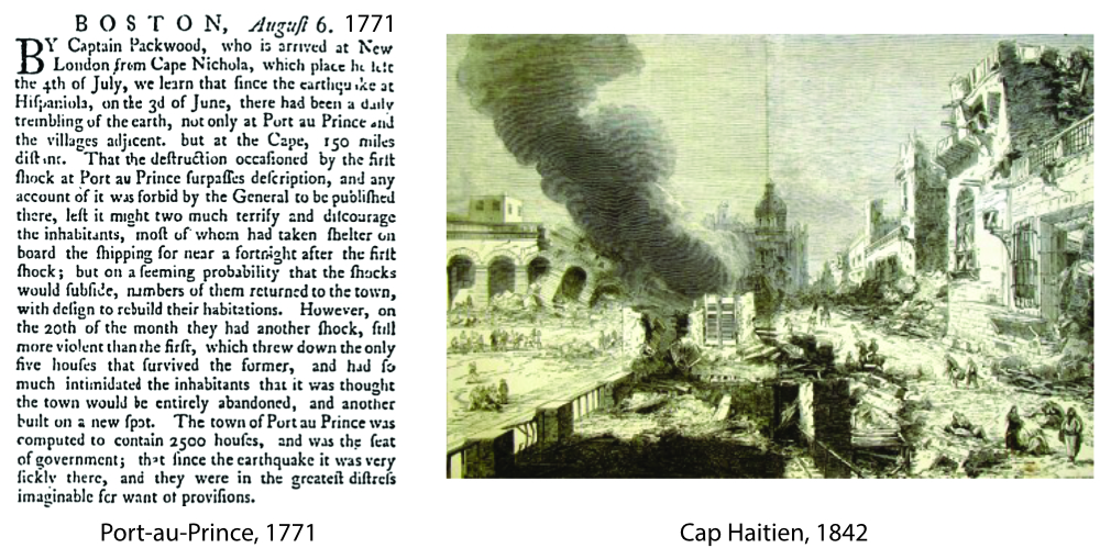
Two archival documents relating to the earthquake of 1771, which caused significant damage, particularly in Port-au-Prince, and the devastating earthquake of May 7, 1842 which seriously affected the north of Haiti, particularly the city of Cap Haitien.
A decade later, as part of the first complete geological mapping of Haiti, the American geologist Woodring and his colleagues completed Scherer’s results by adding, in particular, in the “earthquakes” chapter, two crucial notions. They first noted that, all other things being equal, ground movement is stronger on soft ground (sand, alluvium) than on bare rock: this is the notion of site effect, very important to take into account to quantify the degree of seismic threat in cities, for example. Then they associated earthquakes with the geological faults of the region: this notion, obvious today, was not at the time. This opened the way to the use of geological mapping to determine the seismic threat on a territory.
The lesson learnt is therefore that large earthquakes in Haiti should not surprise anyone: the island has been the site of earthquakes equivalent to, or even more significant, that the devastating event of January 12, 2010 for at least as long as historical archives have existed. There are certainly more large earthquakes to come, hence everyone’s responsibility to prepare.