It has been understood since the 1960s that earthquakes in Haiti are the result of the relative movement of the Caribbean and North American tectonic plates.
Earthquakes were a fundamental element in the demonstration of the theory of plate tectonics because their epicenters follow relatively narrow bands that precisely mark the boundaries between the plates. In addition, movements on faults during earthquakes are indicators of the direction of movement between tectonic plates. It then became clear that earthquakes are the result of mechanical forces exerted in the rocks at the boundaries between the tectonic plates. The faults embedded in the rocks can support these forces up to a certain threshold, beyond which they slip: two compartments of rocks suddenly slide relative to each other along a fault, it is an earthquake. In the Caribbean region, Lynn Sykes, back in 1965, identified 500 earthquakes that followed the contours of what is today called “the Caribbean tectonic plate“.
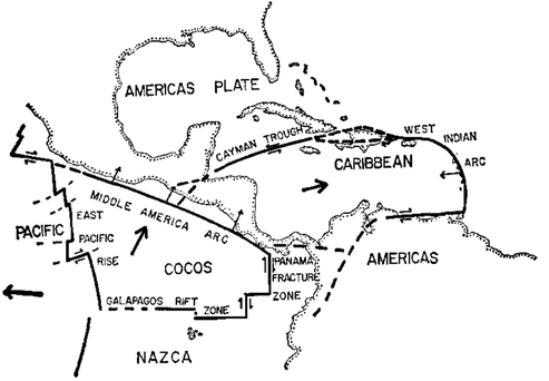
In 1969, Peter Molnar and Lynn Sykes analyzed Caribbean earthquakes to show that, in the northern Caribbean, they result from an east-west directed movement between the Caribbean plate and the North American tectonic plate. They were the first to show that the island of Haiti is located precisely at the contact between these two plates. In fact, the island owes its existence to this geological confrontation. Earthquakes in Haiti have been occurring for millions of years, and this will continue inexorably for millions of years to come.
